OPTIONAL EXTRA DUST BOWL FEATURE
I read the grapes of wrath after riding Route 66 in 2011. Obviously much of the route is that followed by displaced farming families fleeing the devastaion of the 1930's Dust Bowl.
To pass part of an afternoon in Las Vegas, too hot to sensibly venture outside, I shamelessly plundered a few sources on the internet to compile a short summary of the Dust Bowl - as much for my own enlightement as anything else, albeit something of a 'busman's (research) holiday' task.
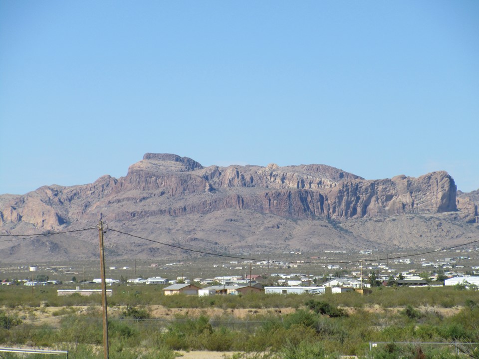
The area affected by the dust bowl included large areas of Kansas, the Oklahoma and Texas panhandles and the western areas of Colorado and New Mexico, characterized by plains with elevation ranges from 2,500 feet (760 m) in the east to 6,000 feet (1,800 m) at the base of the Rocky Mountains. The area is semiarid, receiving less than 20 inches (510 mm) of rain annually, supporting the short prairie grass originally present in the area. During early European and American exploration of the Great Plains, this region was thought unsuitable for European-style agriculture. The lack of surface water and timber made the region less attractive than other areas for pioneer settlement and agriculture.
The federal government encouraged settlement and development of the Plains for agriculture via the Homestead Act of 1862, offering settlers 160-acre (65 ha) plots. With the end of the Civil War in 1865 and the completion of the First Transcontinental Railroad in 1869, waves of new settlers reached the Great Plains, greatly increasing the acreage under cultivation. A return of unusually wet weather seemingly confirmed a previously held opinion that the "formerly" semiarid area could support large-scale agriculture. At the same time, technological improvements such as mechanized ploughing and harvesting made it possible to operate larger properties without high labour costs. The combined effects of the disruption of the Russian Revolution, which decreased the supply of wheat and other commodity crops, and World War 1 increased agricultural prices; encouraging farmers to dramatically increase cultivation.
The widespread conversion of the land by deep ploughing and other soil preparation methods to enable agriculture eliminated the native grasses which held the soil in place and helped retain moisture during dry periods. Furthermore, cotton farmers left fields bare during winter months, when winds in the High Plains are highest, and burned the stubble as a means to control weeds prior to planting, thus depriving the soil of organic nutrients and surface vegetation.
After fairly favourable climatic conditions in the 1920s, the region entered an unusually dry era in the summer of 1930. When severe drought struck the Great Plains region in the 1930s, it resulted in erosion and loss of topsoil. The dry topsoil became friable, reduced to a powdery consistency in some places. Without the indigenous grasses in place, the prevailing high winds picked up the topsoil and created the massive dust storms that marked the Dust Bowl period.
On April 14, 1935, known as ‘Black Sunday’, 20 of the worst "black blizzards" occurred across the entire sweep of the Great Plains, from Canada south to Texas. The dust storms caused extensive damage and turned the day to night; witnesses reported that they could not see five feet in front of them at certain points.


In 1935, many families were forced to leave their farms and travel to other areas seeking work. More than 500,000 Americans were left homeless. Families packed up ‘jalopies’ with a few personal belongings, and headed west in search of work. The Dust Bowl exodus was the largest migration in American history over a short period of time. Between 1930 and 1940, approximately 3.5 million people moved out of the Plains states. It is unknown how many moved to California but in one year, over 86,000 people migrated there. This is more than the number of migrants to that area during the 1849 Gold Rush. Migrants abandoned farms in Oklahoma, Arkansas, Missouri, Iowa, Nebraska, Kansas, Texas, Colorado, and New Mexico, but were often generally referred to as "Okies", "Arkies", or "Texies". Terms such as "Okies" and "Arkies" came to be known in the 1930s as the standard terms for those who had lost everything and were struggling the most during the Great Depression.
During President F D Roosevelt’s first 100 days in office in 1933, his administration quickly initiated programs to conserve soil and restore the ecological balance of the nation. President Roosevelt ordered the Civilian Conservation Corps to plant a huge belt of more than 200 million trees from Canada to Abilene, Texas to break the wind, hold water in the soil, and hold the soil itself in place. The administration also began to educate farmers on soil conservation and anti-erosion techniques, including crop rotation, strip farming, contour ploughing, terracing, and other improved farming practices. The government paid reluctant farmers a dollar an acre to practice the new methods. By 1938, the massive conservation effort had reduced the amount of blowing soil by 65%. The land still failed to yield a decent living.
In the fall of 1939, after nearly a decade of dirt and dust, the drought ended when regular rainfall finally returned to the region. The government still encouraged continuing the use of conservation methods to protect the soil and ecology of the Plains. At the end of the drought, the programs which were implemented during these tough times helped to sustain a positive relationship between America's farmers and the federal government.
The human impact of the Dust Bowl storms is best illustrated by the following passage from Steinbeck’s ‘The Grapes of Wrath’, Chapter 1:
‘When the night came again it was black night, for the stars could not pierce the dust to get down, and the window lights could not even spread beyond their own yards now the dust was evenly mixed with the air, an emulsion of dust and air. Houses were shut tight, and cloth wedged around doors and windows, but the dust came in so thinly that it could not be seen in the air, and it settled like pollen on the chairs and tables, on the dishes. The people brushed it from their shoulders. Little lines of dust lay at the door sills.
In the middle of that night the wind passed on and left the land quiet. The dust-filled air muffled sound more completely than fog does. The people, lying in their beds heard the wind stop. They awakened when the rushing wind was gone. They lay quietly and listened deep into the stillness. Then the roosters crowed, and their voices were muffled, and the people stirred restlessly in their beds and wanted the morning they knew it would take a long time for the dust to settle out of the air. In the morning the dust hung like fog, and the sun was as red as ripe new blood. All day the dust sifted down from the sky, and the next day it sifted down. An even blanket covered the earth it settled on the corn, piled up on the tops of the fence posts, piled up on the wires; it settled on roofs, blanketed the weeds and trees.
The people came out of their houses and smelled the hot stinging air and covered their noses from it. And the children came out of the houses, but they did not run or shout as they would have done after a rain. Men stood by their fences and looked at the ruined corn, drying fast now, only a little green showing through the film of dust. The men were silent and they did not move often. And the women came out of the houses to stand beside their men—to feel whether this time the men would break. The women studied the men's faces secretly, for the corn could go, as long as something else remained. The children stood nearby, drawing figures in the dust with bare toes, and the children sent exploring senses out to see whether men and women would break. The children peeked at the faces of the men and women, and then drew careful lines in the dust with their toes. Horses came to the watering troughs and nuzzled the water to clear the surface dust. After a while the faces of the watching men lost their bemused perplexity and became hard and angry and resistant. Then the women knew that they were safe and that there was no break. Then they asked, ‘What'll we do?’ And the men replied, I don't know. But it was all right. The women knew it was all right, and the Watching children knew it was all right. Women and children knew deep in themselves that no misfortune was too great to bear if their men were whole. The women went into the houses to their work, and the children began to play, but cautiously at first. As the day went forward the sun became less red. It flared down on the dust-blanketed land. The men sat in the doorways of their houses; their hands were busy with sticks and Little rocks. The men sat still—thinking—figuring’.